GTA Map Evolution: From Liberty City to Leonida
The GTA map evolution traced across every era, from the 1997 top-down original through Liberty City, San Andreas, Los Santos, and the State of Leonida.

The GTA map evolution is one of the clearest ways to see how far Rockstar has pushed open-world design, moving from a flat top-down grid in 1997 to the sprawling State of Leonida nearly thirty years later. Each era added more scale, more verticality, and more variety, turning a simple city playground into a living region. Here is how the GTA maps changed across the history of the series.
The top-down origins (1997-1999)
The original Grand Theft Auto, released in 1997 by DMA Design (later Rockstar North), used a top-down perspective that looked down on the action from directly above. Despite the simple graphics, the first game was surprisingly ambitious about geography: it featured three cities, Liberty City, San Andreas, and Vice City, modeled loosely on New York, San Francisco, and Miami. Those three names would echo through the series for decades.
Grand Theft Auto 2 followed in 1999, again top-down but with early 3D tech that allowed smooth camera zoom and dynamic lighting from headlights and street lamps. It dropped the real-city pastiche for a single stylized, retro-futuristic setting called Anywhere City, split into three districts. These early maps were small and abstract, but they established the template: an open city you could drive across freely and cause chaos in.
Going 3D with Liberty City (2001)
Everything changed with Grand Theft Auto III in 2001. The series moved into full 3D, and Liberty City became a place you could walk through rather than look down on. The map was built as three connected islands (Portland, Staunton Island, and Shoreside Vale) that unlocked as the story progressed. By modern standards it was compact, but in 2001 a seamless 3D city you could explore from a street-level camera was revolutionary, and it set the formula every later GTA would refine.
Vice City and San Andreas expand the formula (2002-2004)
Grand Theft Auto: Vice City arrived in 2002, trading Liberty City's grey streets for a neon, Miami-inspired city set in 1986. It was a single city rather than a multi-city state, but the leap in atmosphere, color, and personality showed that a GTA map could be a character in its own right.
Then came the giant leap. Grand Theft Auto: San Andreas in 2004 expanded the playable area to a whole state, combining three cities (Los Santos, San Fierro, and Las Venturas, based on Los Angeles, San Francisco, and Las Vegas) with deserts, forests, and rural countryside in between. At roughly 38 square kilometers, San Andreas was the largest GTA map of the 3D era and would hold that title for almost a decade. It proved the series could handle countryside, mountains, and multiple distinct cities in one continuous world.
HD-era Liberty City and Los Santos (2008-2013)
Grand Theft Auto IV rebooted Liberty City in 2008 on Rockstar's RAGE engine for a more grounded, detailed take on New York. The playable area was actually smaller than San Andreas (community measurements put Liberty City at roughly 6 square miles versus San Andreas's ~14), but the density, physics, and visual fidelity were a generational jump. The map traded sprawl for detail.
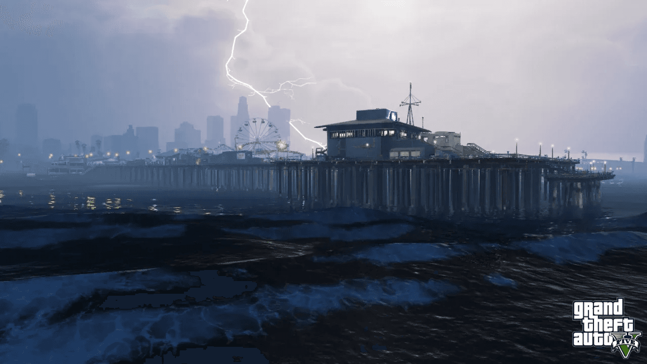
Grand Theft Auto V in 2013 swung back toward scale with Los Santos and Blaine County, a reimagined Southern California. Counting water and underwater areas, the GTA V map covers roughly 76 square kilometers (about 29 square miles), making it the biggest single-player Rockstar map of its time. It paired a dense modern city with mountains, desert, ocean floor, and farmland, and it has stayed relevant for over a decade thanks to GTA Online. You can explore that world's regions on the GTA V hub or browse the GTA V screenshots gallery to see how varied the terrain is.
The State of Leonida (2026)
The newest chapter in the GTA map evolution is Grand Theft Auto VI and its setting, the State of Leonida, a fictionalized take on Florida. Its centerpiece is a modern Vice City (Rockstar's Miami stand-in), surrounded by far more than a single urban core. Officially highlighted regions include the Leonida Keys island chain, the Grassrivers wetlands inspired by the Everglades, Mount Kalaga, and the secondary city of Port Gellhorn.
Rockstar has not published exact square-mileage figures, but the company has described a large, varied state spanning multiple regions, and widely cited community estimates put Leonida at nearly double the playable size of GTA V. Whatever the final number, the trajectory is unmistakable: from a top-down grid with a handful of streets to a full state of cities, swamps, keys, and countryside you can drive across without a single loading screen.
How the GTA maps grew, at a glance
- GTA (1997): top-down, three small cities (Liberty City, San Andreas, Vice City)
- GTA 2 (1999): top-down, single stylized Anywhere City
- GTA III (2001): first 3D map, Liberty City across three islands
- Vice City (2002): single neon, 1980s Miami-style city
- San Andreas (2004): ~38 km², three cities plus countryside, biggest 3D-era map
- GTA IV (2008): denser, detailed Liberty City reboot (~6 sq mi), smaller land area
- GTA V (2013): ~76 km², Los Santos and Blaine County
- GTA VI (2026): the State of Leonida, Vice City plus keys, wetlands, and more
Across nearly three decades, the through-line is consistent. Every GTA map kept the freedom to roam while adding scale, density, and environmental variety, and Leonida is the most ambitious version of that idea yet.